
One of the best tech secrets of modern photography is the ability to never have to write down in a little notebook where you were when you took a photo in order to remember later. Many folks have GPSes in their car, but they aren’t only for getting directions from place to place. A GPS device can also record the very place you were standing when you took a photograph, and save it into your camera’s EXIF data. For those that spend time traveling and chasing trains, a GPS is extremely useful. Photos that have GPS data recorded are known as “geotagged” – and to the modern photographer, it’s the best thing since sliced bread!
Since I’ve mentioned EXIF data, it is certainly worth mentioning this other wonderful part of modern photo. EXIF stands for EXchangeable Image File format, which is basically a way that a photo’s metadata is saved. Each photo taken with your camera has this data, which usually records the date and time the photo was taken (provided you have this set correctly in your camera), the camera make and model, and the settings used to capture the photo – usually the mode setting, ISO, aperture, and exposure. In some cameras you can set specific copyrights (my camera adds my full name and website address to the EXIF data) or other messages. If you have a GPS device linked to your camera, GPS coordinates for when the shot was taken (including the altitude in some instances) are also recorded.
Getting GPS data on your camera
So how do you go about getting your camera hooked up to a GPS device? Many new cameras are coming out with GPSes built right in. One of the reasons why I fell in love with my main camera, the Canon 6D, is the built in GPS. The Sony SLT-A99
, Nikon D5300
, Canon 7D Mark II
, Pentax K-5 IIs
, and Pentax K-S1
are all examples of DSLRs with built-in GPSes. If you don’t have one of those, however, that does not mean you are out of luck. Most manufacturers make external GPS loggers that connect to your camera. The good thing about these devices is that they add the GPS coordinates directly to the photo’s EXIF data. However, they cost about $200 dollars for one actually made by Nikon
or Canon
.
If you’re not looking to spend a lot of money, a good alternative is a cell phone GPS logger. Provided you have a smartphone, you should be able to download a few free or low-cost apps that use your phone’s built-in GPS to record your location. The difficulty with this option is that you’ll have to add the GPS data to your photos as a secondary step later on. The app’s software should make this easy, however, you just need to ensure that your phone and your camera’s time info are set the same way – it will link the GPS points it has saved with the info about when each photo was taken and match them up. You can search your respective app store and find a geotagging app for you, or try out Geotag Photos Pro, which I have used in the past and it worked well.
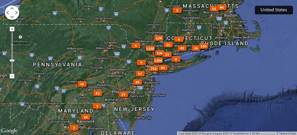
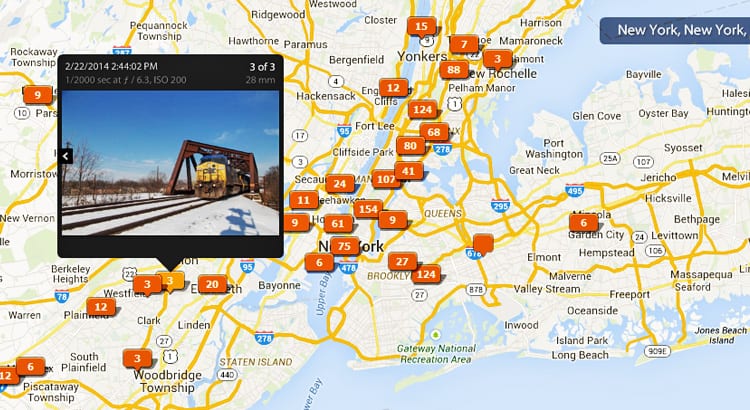
Photo map through Lightroom of my geotagged photos.
Using Geotagged Photos
So now that you have some geotagged photos, what can you do with them? If you use Lightroom to track and edit your photos, there is a map option where you can see all of your photos overlaid on a map, which is quite useful. You can also upload your photos to a site called Panoramio, a site run by Google meant only for geotagged images (this is where the photos overlaid onto Google Maps come from). You can keep track of the places you’ve taken photos on a map, but also what photos others have taken in that area. In a way, you’re helping to build a database of “where to get cool shots” – as I generally use the site to scout out cool places to get photos from.
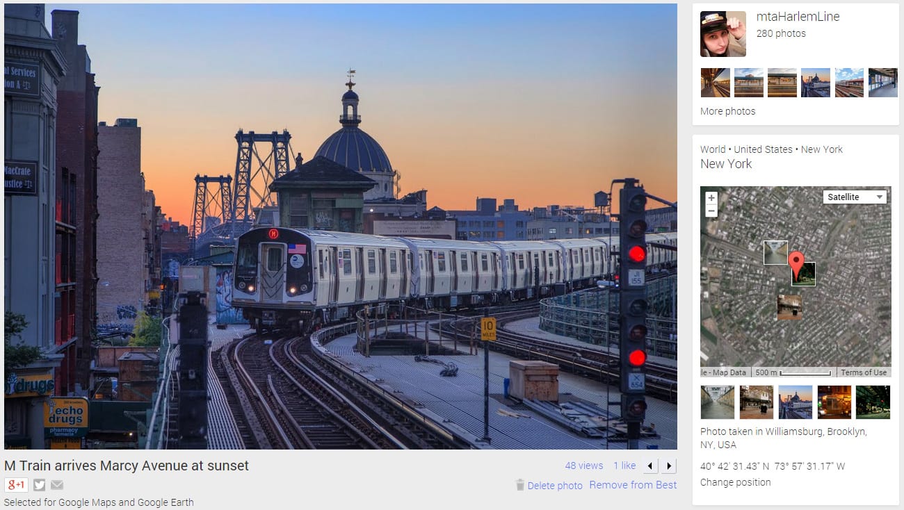
“One of my photos uploaded to Panoramio, showing the location it was taken from
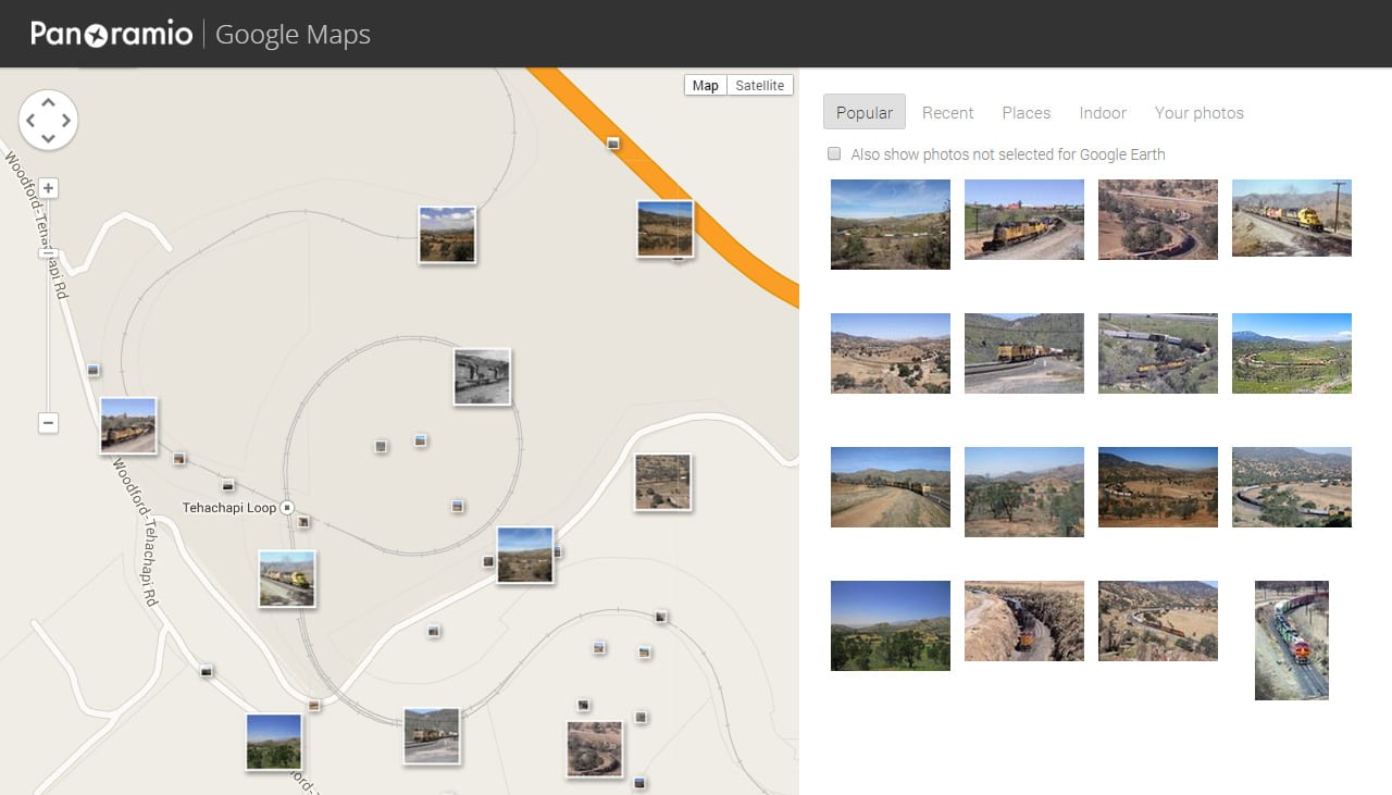
A map search showing all the photos taken of Tehachapi Loop in California, showing where each photographer was standing
If you want to use Panoramio for scouting locations, sometimes the built-in search is a bit clunky. The trick is to use Google’s search itself, find photos that interest you, and then go to the site to find out where the photo was taken. For example, here’s a search for good spots to get photos of the Golden Gate Bridge at sunrise:
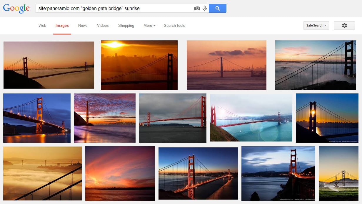
All you have to do is go to images.google.com, in the search box type site:panoramio.com, which means that you’ll only be searching the panoramio.com site, then type your keywords, with phrases in quotes. Here’s what I searched for:
site:panoramio.com “golden gate bridge” sunrise
Though Panoramio is the best example of a site for geotagged photos, as it was designed exclusively for them, various other photo sites are compatible and will show maps for your geotagged photos. Flickr, and even RailPictures.net can show map info for any geotagged photos uploaded there.
Other GPS tools
It is also worth mentioning that railroad companies generally know where their trains are by GPS as well. A few have made that information publicly available. There are both fan-made and official live train trackers, but few beat the well-designed system yielded by an Amtrak and Google partnership. If you’re out in the field, nothing works better than being able to see where exactly the trains are on a map.
![]()
Amtrak’s live train tracker
To access the Amtrak live train tracker, go here, then click on the “Track your Train, Check Train Status” graphic.
So who out there also geotags their photos? Anyone else have a Panoramio account? Have an idea you’d love to see covered in our new series “Trains and Modern Photography”? Drop a line in the comments!
Great article! Railfan Atlas ( http://railfanatlas.com ) is worth knowing about in this context; it’s more or less Google Maps with 600,000+ train images from Flickr overlaid on the top of it.