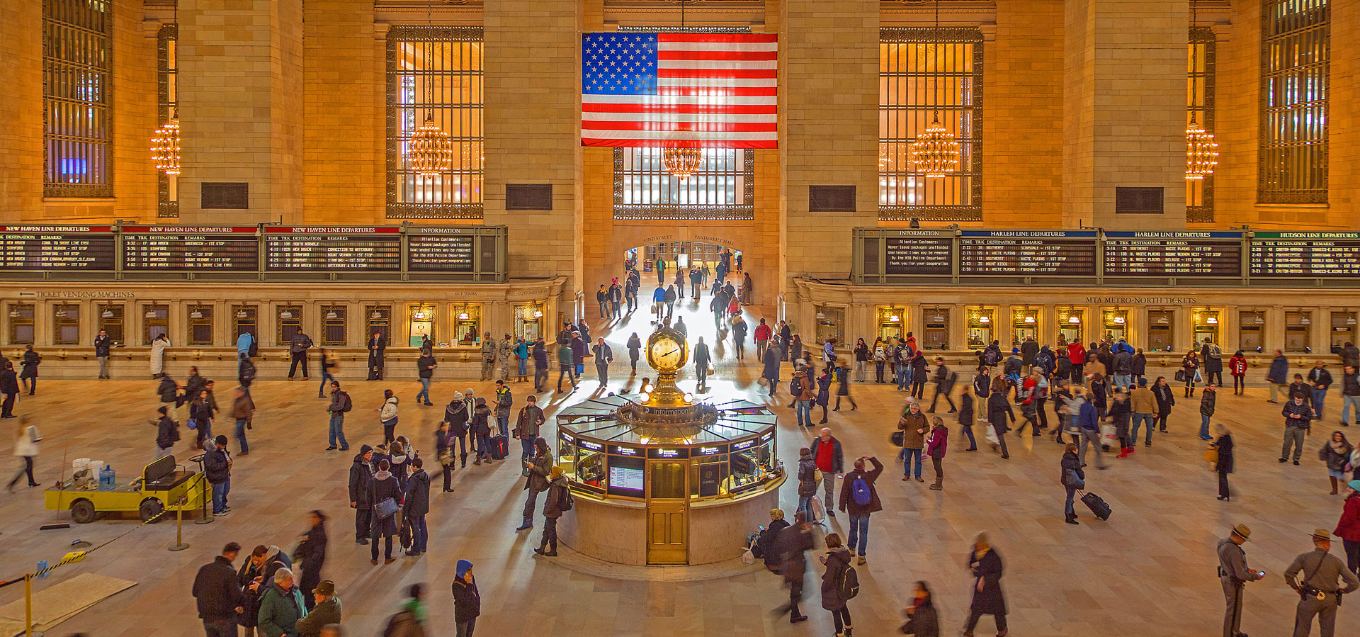
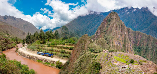
TrainsHistoryObservationsHumorAdvertisementsEventsMuseumsPhotosVideosTuesday ToursPost ArchivesHistorical ArtifactsPanorama ProjectRSS FeedFollow us on twitterSubscribe by email Home

Archive for the ‘Train Stories’ Category

Warren & Wetmore: Grand Central’s Architects on the Harlem Line Train History Photos

Wednesday, May 22nd, 2013

Postcards of White Plains

Before Whitney Warren and Charles Wetmore became known for their work on Grand Central Terminal, they were already known by many of the New York Central’s commuters. A handful of the lovely stations still found on Metro-North’s lines are creations of Warren and Wetmore. Yonkers, on the Hudson Line, as well as Hartsdale and White Plains on the Harlem, were all designed by the duo. Poughkeepsie and Mount Vernon (West) were also designed by them, but after the completion of Grand Central (Scarsdale and Chappaqua were designed by the other Grand Central architecture firm – Reed and Stem).

Postcards of Hartsdale

The American Architect was a lovely periodical that featured details, photographs, and plans of various buildings designed and constructed in the United States, published in the late 19th and early 20th centuries. Flipping through archives of it are pretty interesting, as they feature some amazingly gorgeous buildings. Train stations were occasionally featured, and in 1915 there was an article about two of Warren and Wetmore’s stations on the Harlem Division – White Plains, and Hartsdale.

White Plains plan
White Plains 1
White Plains 2
White Plains station illustrations from The American Architect.

Of primary interest is the portion about White Plains – the Warren and Wetmore station that was torn down in the early ’80s. From the plans and photos, the station looked very much like the still standing station in Poughkeepsie. Several historical buildings in White Plains, including the station, met the wrecking ball as the city strove to update its image, and encourage urban renewal.

The current station, opened in 1987, is a rather ugly substitute for the gorgeous station that was once here. Besides the 38 by 80 foot waiting room, the old station contained various shops, and a shoe shiner. Waxman’s News, which was founded in the old station, and was reestablished in the new, has been one of the few ties between the two buildings – but even that isn’t to last. In the interest of more rent, Metro-North has decided to not renew the leases of either of the two vendors currently in the station. The 30-plus year run of Waxman’s News will come to a close at some point this summer.

 
Construction work on the new White Plains station, completed in 1987. Photos by Lou Grogan.

Hartsdale, on the other hand, is a bit more cheerful of a story. Not only is the station still around, it has been attractively restored. Although a Starbucks probably wouldn’t be my first choice tenant for an old railroad station, it does seem to work. And as long as it allows the building to be preserved, it makes me happy!

Hartsdale Photo

Hartsdale Plan 2

Hartsdale Plan 1

Vacationing on the Railroad, yesterday and today Train History

Friday, May 17th, 2013

It is starting to be that time of the season where everyone is thinking about summer, and about taking vacations. The railroad has always been a great method of getting around, and there are plenty of places you can see by train. If you’re looking for something more local, Metro-North will be having their Staycation Showcase in Grand Central next week. Amtrak also has a wide variety of places to vacation, all accessible by rail.

Despite all of these offerings, rail travel really isn’t the primary method that most people go on vacation these days. After getting patted down by your friendly neighborhood TSA, airlines can whisk you away to the other side of the country in a matter of hours, not days. And America’s love affair, the automobile, offers a more individualized and customizable trip across our nation’s Interstate system. However, neither of these options were available to folks living in the early 1900s. Rail was the way to go, and the best way to take a vacation.

New York Central vacation brochures
Vacation brochures printed by the New York Central in 1908 and 1903.

Vacation packages, including rail tickets, were offered by the New York Central, and they printed many varieties of brochures advertising all the places one could visit. Summer resorts included in-state locations, like Niagara Falls and the Adirondacks, and some faraway places like Canada, Michigan, and even Yellowstone National Park – an 82 and a half hour trip from Grand Central Terminal, at a round trip fare of $97.80.

The winter resorts booklet might prove to be the most interesting – it offered long distance vacations to warm locales around the world – places that one would reach after long journeys via train and steamship. Setting out for “one of ‘Uncle Sam’s’ new possessions” – “Porto Rico” – would be a 20 day affair in total. The most fascinating part printed is certainly the map of the Pacific Ocean found at the back of the brochure, labeled as places “reached by the New York Central Lines and their connections.” If you had the time, and the money, you could certainly reach the Empire of Japan, and beyond. Straying not too far from home, a traveler could reach Honolulu by steamship from San Francisco in a total of seven days.

Map of the Pacific
Map of the Pacific Ocean, printed by the New York Central in their 1903 America’s Winter Resorts brochure.

Interested in staying closer to home, or taking a shorter vacation? The New York Central also had a brochure of journeys taking two to fifteen days. Two days could get you to the Adirondacks or Lake George, four a nice trip to Montreal, eight a meandering journey to and from Quebec, and fifteen a wonderful itinerary stopping at several different resorts in many of the aforementioned spots.

Two to fifteen day journeys
Brochure of two to fifteen day journeys from 1912, and the Harlem Division map within.

If you’re really looking to stay in your own backyard, there were plenty of vacationing spots along the Harlem Division. The Harlem’s long-gone Lake Mahopac branch was established especially for that purpose. But as you can see from the map above, one could get more places via the Harlem than you can today – transfers were available in Chatham for the Boston and Albany Railroad to Massachusetts, and to the Rutland Railroad for Vermont.

Resorts on the Harlem
Close to home – summer resorts along the Harlem.

Anybody out there planning on taking a vacation (or a “staycation,” even) by train this summer? Drop a note in the comments about where you’re planning on going!

The Budd Rail Diesel Car, and more art from Leslie Ragan Train History Photos

Tuesday, April 23rd, 2013

If you’ve been following our little series of posts chock full of lovely Leslie Ragan art in advertisements for the Budd company, you may have noticed a few ads featuring Budd’s RDC – or Rail Diesel Car. Today’s post completes our collection of Ragan ads, and focuses on the RDC. The RDC’s were widely used here and around the world – Australia, Canada, Brazil, and even Saudi Arabia all had RDC’s operating at some point in time.

The versatile RDC was an all stainless steel, self propelled railcar that could be operated as a single unit, or multiple cars could be coupled into one longer train. While they operated on all sorts of runs, it was common to see them on lines with fewer passengers, and in commuter service where there was no electrification – like the Upper Harlem Line.

 
Budd-built cars operating on the Harlem Line – at left, an RDC at Dover Plains, at right an SPV-2000, also in Dover Plains. While the RDC was highly successful, the supposed successor SPV was hardly so – acquiring the less-than-flattering nickname “Seldom Propelled Vehicle.”

Here’s the last few ads with Ragan’s art, all advertising the RDC:


Ragan’s art successfully made the RDC look rather dreamy. Realistically, the RDC, with its stainless steel body, was somewhat attractive. By today’s standards, the inside does look a bit dated though. Here are a few Budd promotional photos of the RDC:


Top: A New York Central RDC-3. This model featured seats for 48 passengers, and room for baggage and mail. Bottom: Passengers board a New Haven RDC.

 
Left: Construction on the inside roof of an RDC. Right: An RDC in action.

The first RDC’s were offered in four different models, numbered 1 through 4. The RDC-1 was for passengers only, and seated 89. The RDC-2 seated 70 passengers, and had a 17 foot baggage compartment. The RDC-3 combined passenger seating with baggage and mail, it accommodated 48 passengers, a 17 foot baggage compartment, and a 15 foot mail apartment. The RDC-4 carried no passengers, and had a baggage compartment measuring 31 feet, and a mail apartment 30 feet long. Ever curious what the first four versions looked like? Here are the schematics, which were published by the Budd Company in a 1953 promotional booklet called “RDC Comes of Age.”


Riding the Alaska Railroad, Part 2 Train Photos

Tuesday, April 9th, 2013

After last week’s journey along the Alaska Railroad to around Hurricane Gulch, we continue today with the remainder of the ride to Fairbanks. This includes passing through Denali National Park and Preserve, though no one was looking to disembark in the frigid weather (we did see some ice climbers from the window, however). Further north was the small town of Healy, which contains the Usibelli coal mine, Alaska’s only operating coal mine. The coal from the mine is shipped southward by the Alaska Railroad to Seward, where it is loaded on ships for export, or north to other interior locations in Alaska.

Usibelli's coal ships via the Alaska Railroad
Usibelli’s coal ships via the Alaska Railroad. The mine is connected to the railroad main line by a rail spur.[1]

Beyond Healy is the town of Nenana, once a large population center with several thousand residents. According to the 2011 census[2] there are only 383 residents today. Nenana depot, opened in 1922, still stands, and the Aurora train reached it around sunset. The Alaska Railroad itself was completed just north of the depot in 1923 with the Mears Memorial Bridge.[3] President Harding drove the ceremonial golden spike at the north end of the bridge, linking the two sections of rail. Beyond the bridge the passenger portion of the Alaska Railroad terminates in Fairbanks. The railroad itself extends at least to Eielson Air Force base, which is freight only. In fact, some of the aforementioned Usibelli coal is shipped to and used at the base.

Artifacts of the Alaska Railroad
Brochure and matchbook cover from the Alaska Railroad. [4]

While we traveled from Anchorage to Fairbanks, the only route open to passengers during the winter, the Alaska Railroad’s main line is more than a hundred miles longer. Extending southward to Seward, the line also branches off to the port of Whittier. Along these rails glaciers are visible from your train seat, and one of the routes is aptly named the Glacier Discovery.

When it comes to railroad history, Alaska’s rails are a bit young compared with some of the other lines we normally cover on the site. The New York Central can claim history back to 1826, and the Harlem to 1831 – Alaska’s first dates back to 1903.[5] The predecessor Alaska Central Railway went bankrupt by 1907, and was reorganized as the Alaska Northern Railway Company, operating an approximately 70 mile stretch of rail extending north from Seward. Construction on a real Alaskan railroad began in earnest in 1914, when Congress agreed to fund the construction and operation of a railroad from Seward to Fairbanks (Alaska had officially been incorporated as a US territory in 1912). Anchorage, Alaska’s most populous city today, was formed as a railroad town during the construction. Populated by construction workers of the now-named Alaska Railroad, Anchorage officially became the headquarters of the railroad by 1915.

Today the Alaska Railroad is owned by the state of Alaska, and it operates both freight and passenger service. On the passenger side, as of 2012, the railroad owns a fleet of 44 railcars (excluding locomotives), which consists of 2 business cars, 6 diners, 11 passenger coaches, 6 vista dome coaches, 7 low-level dome coaches, 6 bi-level ultradomes, 1 bi-level diesel MU, and 5 baggage cars.[6] In 2011 the railroad carried 412,200 passengers, 265,335 of which were from cruise ships. Outside of cruise passengers, the Denali Star is the railroad’s most popular passenger train, followed by the Coastal Classic.

That is about it for today’s post on Alaska – there will be one more Alaska post forthcoming, and it will contain dogs and penguins… everybody likes dogs and penguins, right?


  1. Usibelli coal photograph via Alaska’s Department of Natural Resources []
  2. Census data from the US Census Bureau via Google []
  3. A history of the Mears Memorial Bridge. []
  4. Alaska Railroad brochure and matchbook covers from the author’s collection []
  5. Timeline history of the Alaska Railroad []
  6. Statistics from 2012 Alaska Railroad Passenger Services Business Report. []

Sad train is sad… Train History

Friday, March 1st, 2013

Sad train is sad...

Fare increases are in inevitable but depressing reality when it comes to riding the train. Starting March, Metro-North has unfortunately had to raise fares yet again. This, of course, has happened many times throughout history. In 1951 the New York Central distributed a brochure to Harlem and Hudson commuters regarding an upcoming fare increase, which I’d like to share with you… complete with an anthropomorphized sad train. Sad train is sad :(

Brochure Part 1

Brochure Part 2

All Aboard the Panda Special! Train Events History

Monday, February 18th, 2013

While the Grand Central Centennial celebration on February 1st was primarily dedicated to our beloved Terminal, we also took a few moments to remember the life of Edward Koch, who passed away earlier that morning. There are many ways that one can remember the late Ed Koch – as a congressman, as a mayor, as a consummate New Yorker, and even as a preserver of Grand Central (and if you’re as young as me, perhaps only as that judge on the People’s Court). But the thing that probably won’t come up in most people’s memories, however, are pandas. It certainly was not one of Koch’s most noteworthy accomplishments, but he did succeed in getting two pandas for New York City, if only for a few months.

Pandas!
Mayor Ed Koch and Chinese Premier Zhao Ziyang on his visit to New York in 1984, and a newspaper article mentioning Koch’s request for pandas.

As the story goes, Mayor Koch hosted Chinese Premier Zhao Ziyang for lunch at Gracie Mansion in 1984. In a private moment, Koch requested two pandas from Ziyang, stating, “If I get two pandas, I’ll get re-elected.” Koch later attributed, in jest, his 1985 reelection to Zhao’s statement to the media, “It is possible that New York City will have two pandas.” The negotiations for the rare ursids was said to take, in total, seven years – and in April of 1987 two pandas finally arrived at JFK airport on a flight from Beijing.

Panda excitement!
Everyone is excited for the pandas on opening day! Children visit the zoo with masks and signs, and Mayor Koch stands with Deputy Mayor of Beijing, Feng Mingwei.

For the next six months the two pandas, one male and one female, called the Bronx Zoo home. Ling Ling, the male, (not to be confused with the panda of the same name given to the US as a gift by China in 1972) was one and a half years old and weighed 119 pounds. The second panda, a female named Yong Yong, was 6 years old, and weighed 187 pounds. Yong Yong was on her second visit to the United States, she had previously been exhibited in California in 1982. After six months at the Bronx Zoo, the pair moved to Busch Gardens in Tampa, before returning to Beijing in April of 1988.

Bronx Zoo Panda
Panda at the Bronx zoo in 1987. Photo by Tony Savoca.

Now Mayor Koch and two adorable pandas certainly make a good story, but I’m sure you’re wondering how exactly this relates to trains. Apparently the pandas whipped everyone into quite a fervor – the zoo expected 1800 visitors would see them an hour – and not everyone would arrive by car. For those that opted for public transportation, Metro-North not only offered special tickets to the zoo, they printed special timetables as well. Appropriately printed in black and white ink, the timetables featured two pandas on the front, and included a map for getting to the zoo. The illustration of the pandas was done by Victor Chan, who was a graphic designer in Corporate Communications for Metro-North in the late ’80s.

Metro North Panda Timetable

Metro North Panda Timetable

Until I had found this timetable at a train show, I had no idea that there were ever special panda trains, or that the Bronx Zoo had ever had pandas. Pandas are always a top favorite in the animal kingdom for many, yet they are exceedingly rare – especially so in the United States. At this time, there are only 12 pandas in the entire country. So Koch’s temporary acquisition for the zoo was definitely a big deal. And these trains, and the timetables printed for them, may be some of the most interesting in Metro-North’s 30 year history.

For those curious about the fate of the two aforementioned pandas, both lived fairly long lives but are now deceased. Ling Ling was given as a gift to Japan in 1992, and resided in Tokyo’s Ueno Zoo. He died of heart failure in 2008 at the age of 22. Yong Yong spent the remainder of her life in China at various different zoos. She gave birth to ten cubs, and is the grandmother of Ya Ya, one of 12 pandas living in the US, residing at the Memphis Zoo. Yong Yong died at the Beijing Zoo in 2006, at the age of 25.

Tuesday Tour of Metro-North: A new system map Train

Tuesday, January 1st, 2013

By now you are probably aware that I finally finished my three-year-long project to photograph every Metro-North station – all one hundred and twenty three of them. For my “final” Tuesday Tour post, I thought it would be nice to post a map which links to the photographic tours of every station. Though I’ve tried my hand at doing some Harlem Line maps in the past (they were crappy) and made an acceptable stab at a map of the West of Hudson Lines, I never really attempted a system-wide map. I’m not the biggest fan of Metro-North’s maps, especially how they deal with multi-line stations like Fordham (admittedly, it is not a bad map when you compare it to this atrocious Metro-North publication!), so I wanted to do something drastically different.

I guess when I say drastically different, I mean cleaner, hopefully easier to read, and showing info that the official map does not contain. One addition was Metro-North’s extra services, namely game/special event trains. Including them explains visually how Metro-North’s main lines connect, something most railfans probably know, but the average rider may not. The official map doesn’t properly illustrate that the Harlem and New Haven Lines run side by side up to Woodlawn, that they can both head onto the Hudson Line for Yankees games, or that the New Haven Line can diverge and follow Amtrak’s path into Penn Station and Secaucus for football games. Other additional info I included are limited-service stations, and shared stations. A handful of Metro-North’s stations also have Amtrak service, and in the case of New Haven station, Amtrak and Shore Line East service.

In all, my map is more of a “diagram” than anything. Some geography has been compromised a little bit for easier viewing and aesthetics. But every station name and dot links directly to its respective Tuesday Tour full of photos and history, so it is certainly an interesting way to see the system as a whole. Since the map is large, it will open in a new window. Click the preview image below to launch the map!

Metro-North Map Preview

In terms of plans for this year, now that the Tuesday Tours are finished (since you all seem dying to know), I think I want to go back to my roots. That means revisiting the Harlem Line. I know that some of you don’t really like this idea, or think it would be redundant – nonetheless, I don’t think I can legitimately call this site “I Ride the Harlem Line” and have such a poor showing in terms of station tours. For example, compare the first Tuesday Tour of Wassaic to the final one of Poughkeepsie. Wassaic’s tour contains 11 current day photos. Poughkeepsie’s had 37 current day photos, 15 historical photos, and a wide array of historical tickets and timetables. In other words, there really is no comparison. Plus it will be interesting to revisit several stations – Fordham was renovated since I was last there, and it would be super cool to not get the cops called on me when I go back to Melrose! Anyways, look forward to an updated tour of the Harlem Line later on this year!

Best of 2012, a year-end review Train

Friday, December 28th, 2012

2012 has been an interesting year here at I Ride the Harlem Line… we finished up touring the stations on the New Haven, Port Jervis, Pascack Valley, and Hudson lines, as well as visited some places far outside Metro-North’s territory. As if that wasn’t enough, we also began our Grand Central 100 for 100 Project, posting one image every day for 100 days, all to celebrate Grand Central Terminal’s centennial.

As is customary around the end of the year, let’s take a look back at what was most popular on the site this year, based on the number of reads… presenting the top 15 posts of 2012:

15

Starting off our countdown at number 15 is a photographic look at the old Milwaukee Road Depot in Minneapolis. Completed in 1899, the old station was renovated and turned into a hotel. An old train shed now offers an ice skating rink. This is one of a few posts on the blog about Minneapolis this year, from my visit there in April. Some of the other stuff from Minneapolis included the Stone Arch Bridge, a former railroad bridge converted to pedestrian use, riding around on the Hiawatha Line, the old and new Minnehaha Station, and the classical music playing Lake Street – Midtown station.

14

14th most viewed for the year is our Hudson Line tour to Yonkers. The nicely restored brick station at Yonkers, built by the New York Central, is definitely one of the gems of the Hudson Line.

13

There are plenty of hoaxes and tall tales related to Grand Central Terminal, but only one of them made our top fifteen list this year. Coming in at number 13 is the 1929 hoax in the Information Booth. As the story goes, a tricky scammer convinced a fruit seller that the railroad was planning on selling space in the information booth, and that prime space could be turned into a fruit stand. Of course, it was a complete lie, and the scammer skipped town with a nice wad of cash. Amusingly, you can buy apple in the Terminal today – either in Grand Central Market, or in the figurative sense, the Apple store in the main concourse.

12

Another Grand Central themed post comes in at number 12 on our countdown – featuring the sky ceiling that nobody really knows about. This painting can be found inside Grande Harvest Wines – it is the last surviving remnant of the 242-seat newsreel theater that was once in Grand Central Terminal.

11

Our tour of New Haven Line station Mamaroneck makes the list at number 11. Mamaroneck has a lovely old station that was undergoing a transformation into a restaurant called the Club Car – we managed to get a sneak preview of the place, and shared it along with the station tour.

10

The Hudson Line tour of Tarrytown station also makes the list, likely for our coverage of the new and most wonderful Arts for Transit piece by Holly Sears. The 1898 Richardsonian Romanesque-style station at Tarrytown was built by architectural firm Shepley, Rutan and Coolidge, who are most known for their stations on the Boston and Albany railroad.

9

Ninth most popular for the year was my first foray into 3D modeling, and 3D printing. I decided I would try to model the Harlem Line’s Brewster station from historical photos – basically how it looked when it was first built. The interesting journey  was featured in various places around the internet, including the TinkerCad Blog, Shapeways Blog, Adafruit and Wired.

8

One of the more memorable things I got to do this year was to have a brief chat with Metro-North Railroad President Howard Permut. Having been with Metro-North since its inception, the man has a pretty interesting viewpoint regarding the history of the Harlem Line. We talked about Metro-North’s formation from ConRail, Millerton, and other admirable rail systems, among other things.

7

Before touring the Port Jervis and Pascack Valley lines, I wrote a brief introduction to the West of Hudson lines, which was the seventh most viewed post on the site this year. The intro included a few maps, time tables, and a look back on the damage Hurricane Irene wrought on the Port Jervis line.

6

Sixth on our top 15 countdown is a trip to Metro-North’s Operations Control Center. This is the workplace for the railroad’s Rail Traffic Controllers – one of the most stressful and possibly thankless jobs at Metro-North. The current OCC is certainly high tech, but we also got a glimpse of the old OCC, and an ad for one of the New York Central’s historical towers in Grand Central – which looked quite archaic in comparison!

5

One of the most memorable shots of Hurricane Sandy was this capture of a boat resting on the Hudson Line’s tracks in Ossining, which I couldn’t help but turn into an image macro. In other news, whoever happens to own that boat is probably a big asshole, as it seems to be named after a Nazi warship. I guess the owner never realized his boat would end up on the front page of several newspapers – or top 5 in our countdown.

4

Fourth most popular for the year was our April Fool’s prank about Harlem Line service getting restored up to Millerton, complete with two fake timetables and a fake ticket. Rumor has it, some folks in Metro-North’s customer service department hate me even more than they did before after this trick!

3

Coming in at third most popular is the Grand Central 100 for 100 project, featuring 100 historical photos of the Terminal in the hundred days leading up to its centennial. By now we’re more than halfway through, so if you aren’t following the project on Facebook, you totally should be!

2

It appears that everybody loves Dobbs Ferry station, as our tour was the number two most read post on the site for 2012. Featuring another Richardsonian Romanesque station by Shepley, Rutan and Coolidge, Dobbs Ferry also has a nice location right on the Hudson River’s waterfront.

1

Everybody seems to say that the cat is the internet’s unofficial mascot, and it certainly seems that is true! By far, the number one most read post on the site was about Sadie the Subway Cat, of the New York Transit Museum. In addition to our March photo session with the popular feline, we updated you on Sadie’s subsequent retirement, and a humorous update on her new life outside the museum.

That just about wraps up 2012 – I’m definitely looking forward to bringing you new things in 2013… everybody have a Happy New Year!

Tuesday Tour of the Hudson Line: Poughkeepsie Train Photos

Tuesday, December 25th, 2012


1890 photo of the previous Poughkeepsie station. Note that this station was on the west side of the tracks, while today’s station was constructed on the east side of the tracks.


1960 photo of Poughkeepsie station, not obstructed by Route 9 which now runs above the station’s front parking area.

Today we’ve arrived at the end of the line – both literally and figuratively. Today’s station tour is of Poughkeepsie, the northern terminus of Metro-North’s Hudson Line, and the final station on our Hudson Line tour. In fact, it is the final Metro-North station to be featured here. Over the past three years I’ve taken you to all one hundred and twenty three Metro-North stations, on both sides of the Hudson River. I saved Poughkeepsie for the end, as it is truly a gem, and a worthy send off for our Panorama Project.

tts
A wide variety of timetables from Pougkeepsie, including two of Amtrak’s trains that stop here.


Tickets and things from Poughkeepsie. My favorite is the Metro-North ticket listing the station as “Pokipse.”

Located on the east bank of the Hudson River, Pougkeepsie is roughly equidistant between New York City and Albany, and the station is about 75 miles from Grand Central. Both the access to the river, and later the railroad, played a significant part in Poughkeepsie’s growth. Over the years Poughkeepsie has been home to a various array of industries, including a glass factory, dye factory, brewery, carpet mill, shoe factory, and a chair manufacturer, among many others.


At Poughkeepsie station, 1971. Photos by Steve Baldwin.

Reflecting Poughkeepsie’s important status along the New York Central’s famed Water Level Route, a grand station was constructed in 1918. The four story concrete and brick building was designed by the notorious Beaux Arts architects Warren and Wetmore. No strangers to the New York Central, Whitney Warren was a cousin of the Vanderbilts, and designed Grand Central with duo Reed and Stem. Poughkeepsie station is not nearly as extravagant as Grand Central, but along with the station in Yonkers, it is certainly one of the Hudson Line’s real gems.


Poughkeepsie in the 1970′s. Top left photo in 1975, right and below, 1979. Top right photo by Panoramio user Scotch Canadian.


Top left photo in 1979 by Panoramio user Scotch Canadian. Top right photo in 1981 by Bob Coolidge. Amtrak photo by Ed Linde.

Fitting with the typical design of a Beaux Arts building, Poughkeepsie station offers a main, and large, focal point – in this case, the waiting room. Featuring five massive windows that stretch from almost floor to ceiling, during the day the station is well lit just from sunlight alone. To supplement that light, three chandeliers also hang from the ceiling, and similar to Grand Central’s chandeliers, boast their modern use of electricity with naked light bulbs. Interspersed throughout the waiting room are fourteen wooden chestnut benches, also similar to the benches that were once in Grand Central’s main waiting room. Historically, the north wing of the station was reserved for a railway express agency, and the south end with a kitchen and dining room. Today, the waiting room contains a Metro-North ticket window, some Quik-Trak machines from Amtrak customers, restrooms, a snack shop on the south side, and an MTAPD station on the north end.

 
Photos of the former Poughkeepsie Railroad Bridge, now the Walkway Over the Hudson. Photo on the right by Flickr user miningcamper.

Arriving at Poughkeepsie by train, likely the first thing you’d notice is the large bridge running overhead, and not the station building itself, which is less visible on the track side. Constructed in 1888, the Poughkeepsie Railroad Bridge stretches from Poughkeepsie on the east side of the Hudson River, to Highland on the west. Today this bridge makes Poughkeepsie an even more attractive destination. After serving railroad traffic for more than 75 years, the bridge was heavily damaged by fire and was for the most part abandoned until the early 2000′s when it was converted to pedestrian use as the Walkway Over the Hudson State Historic Park.

 
CSX at Poughkeepsie. Photos by Mike Foley.


Poughkeepsie station in 2011, while undergoing renovations. Photo by Mike Groll.

Today Poughkeepsie station is quite attractive, with Metro-North having spent more than $22 million dollars to restore and improve it. This included an ample parking garage on the west side of the tracks, and a walkway and pavilion for people heading to the waterfront. Renovations to the area continue, including an elevator to make accessing the Walkway over the Hudson from the station easier.

Though a bit bigger than most Metro-North stations, the setup is relatively similar. Pretty much every station has ticket machines, wire benches, and blue trash bins, as does Poughkeepsie. Unlike most other stations, Poughkeepsie has one island platform, and two side platforms, although the one side platform is lower level and not used by passengers. All of the tracks are accessible to the main station by an overpass, which also connects to the parking garage. The overpass, covered in attractive wood paneling, is far nicer than the relatively utilitarian overpasses you see at most Metro-North stations.

In all, Poughkeepsie is a lovely station, and definitely worth visiting, if only for the lovely historic station, with the New York Central sign on the front. But a wide variety of restaurants and attractions in the area, most especially the Walkway Over the Hudson, make Poughkeepsie one of the nicest places we’ve seen on our now complete Metro-North tour.


Tuesday Tour of the Hudson Line: Marble Hill Train History Photos

Tuesday, December 18th, 2012


The old station at Marble Hill, pictured in 1927, and in 1946.

As we’ve toured the Hudson Line, we’ve encountered several stations with fairly confusing backgrounds. There are stations that nobody seems to be able to spell correctly, like “Spitendivel” and “Pokipse.” And there’s also Ardsley-on-Hudson, which isn’t in Ardsley, and shouldn’t be confused with the former Putnam Division station of Ardsley (despite the fact that the New York Central printed Ardsley-on-Hudson timetables as just Ardsley). Today’s tour takes us back to the Bronx, to another station also surrounded in a bit of confusion – Marble Hill.


Views of the tracks near Marble Hill in 1935.


Special timetable with new daytime trains for the West Bronx stations, including Marble Hill… where that Bronx name is subject to debate.

If you were to look at any of the local timetables printed by the railroad, or even at a map, you’d likely get the idea that Marble Hill is part of the Bronx. On the other hand, I probably have at least one person that wants to hit me for calling Marble Hill part of the Bronx in the paragraph above. As New York City grew, we humans have significantly changed the landscape of Manhattan island and beyond – and I’m not just talking about massive buildings and skyscrapers. At one point in history, Marble Hill – named for the marble quarries once located here – was part of Manhattan island. When a canal was built to link the Harlem and Hudson Rivers, Marble Hill was separated from Manhattan and became its own island. And when, in 1914, the original course of the Harlem River was filled in, Marble Hill became connected geographically with the Bronx.

Marble Hill, then and now
Map of the Marble Hill area from 1895 (when the canal was completed), and an aerial view of what the area looks like now. Note the “island” of Marble Hill on the 1895 map.

Politically, residents of Marble Hill vote for the Manhattan Borough President, Senator, City Councilman and Assemblyman. But due to the geographic nature of the area, Marble Hill is serviced by the police, emergency and fire department from the Bronx. Because of the general confusion, residents of Marble Hill end up in the archaic directory known as the “phone book” for both the Bronx and Manhattan, and letters written to either borough will be delivered by the US Postal Service. Nonetheless, Metro-North considers it part of the Bronx, and you’ll find Marble Hill listed in the local timetable for the West Bronx.

 
Around Marble Hill in the ’60′s. Photos by Herbert Maruska.

The current Metro-North station at Marble Hill is located a bit more north than the historical station operated by the New York Central. The old station had four tracks running by it (visible in the photos above), where the current station only has three. Both locations, however, are easily within walking distance of the 225th Street subway station, which has a significant effect on the ridership at the station.

In 2008, Metro-North reported that over 900 people were using Marble Hill station, but only 100 were using it to get to Grand Central. At least 300 people were getting off southbound Hudson Line trains and transferring to the subway. Another 300 were using Marble Hill for the reverse commute, possibly making the connection with the subway. Although it would likely lengthen the commute time, many people may be doing this as a cost saving measure. For example, a Tarrytown to Grand Central monthly would cost $266, but a Tarrytown to Marble Hill monthly only costs $88. Purchasing that along with an unlimited-ride Metro-Card would yield a savings of $74. For others, the subway may just provide easier access to their places of work.


Some non-Metro-North action in Marble Hill. Seeing Amtrak trains at Marble Hill is a rarity, as they generally branch off from the Hudson Line before Spuyten Duyvil, unless for some reason they need to be detoured. Photos by Mike Foley.

Besides the geographic anomaly and the unique ridership of Marble Hill, the station really is typical of Metro-North. You can find the same station signs, wire benches, blue trash bins, and ticket vending machines as almost every other station. The station itself consists of a short island platform, connected to street level with an overpass, which contains the aforementioned ticket machines. The station is located right alongside the river, and visible from the station is the Broadway Bridge, which connects both cars and subway trains to Manhattan.

That about wraps things up for Marble Hill – next week we’ll feature our final Tuesday Tour of the Hudson Line, Poughkeepsie.