
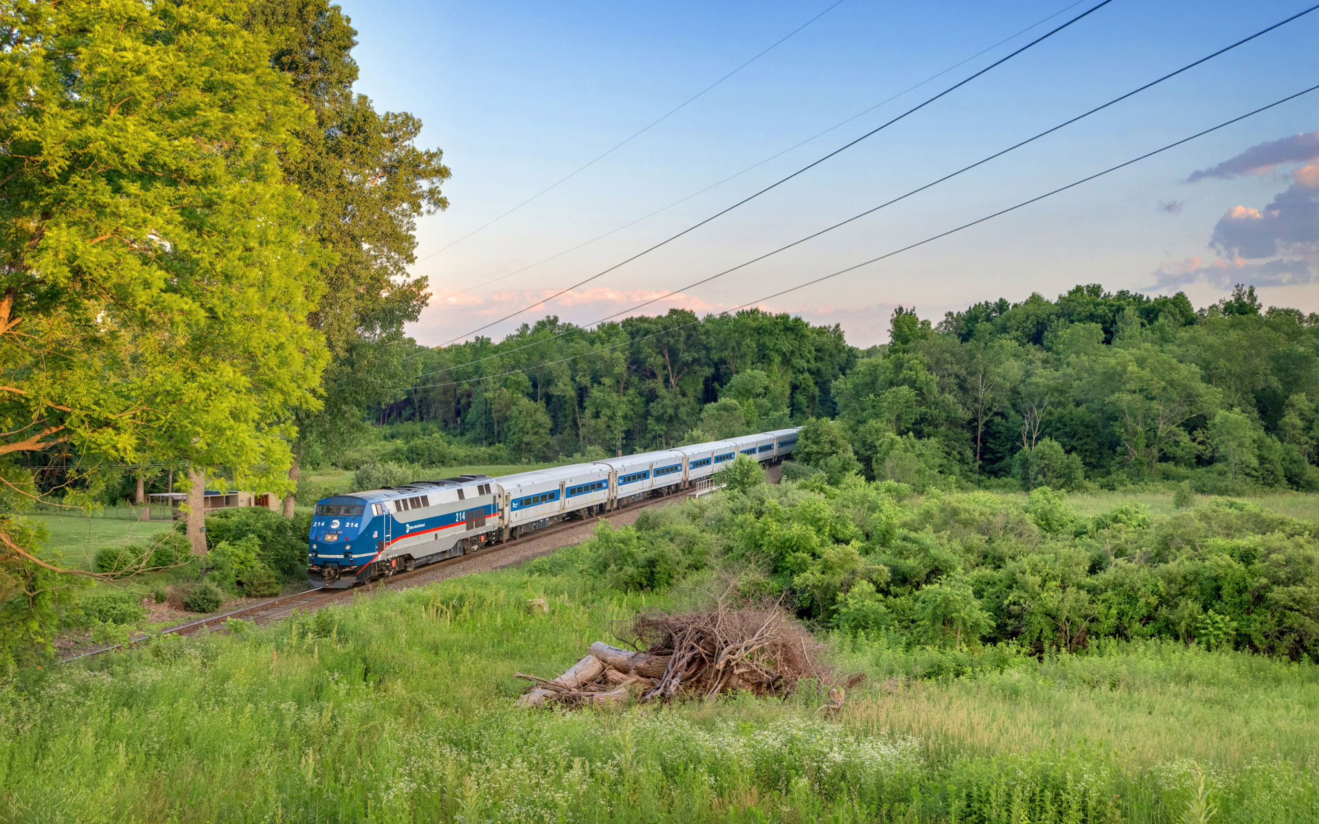
The next time you find yourself on a Metro-North train going past Valhalla Station, be sure to take a look out your window, facing eastward. You’ll be able to catch a quick glimpse of the Kensico Dam as the train goes by. The dam holds back the waters of the Kensico Reservoir, the primary source of water for the city of New York. The 98-acre grounds around the dam are a county park called the Kensico Dam Plaza. While the weather was warm last week, I took the opportunity to have lunch at the park, and of course I took lots of pictures. Kensico Dam Plaza is one of the many interesting places to visit in the area within walking distance of Harlem Line stations (In this case, Valhalla). In addition to the dam, the grounds also contains a September 11th Memorial, called The Rising, designed by architect Frederic Schwartz. The memorial lists the names of all one hundred and eleven Westchester County residents that died in the attacks.


The original Kensico Dam was built in 1885 and created a small lake with water from the Bronx River, as a source of water for New York City. As the city expanded, the dam could not fulfill the city’s need for water, and was eventually expanded. This expansion required the land from the village of Kensico, and so the property of the entire town was purchased to make room for the new dam. The former town now rests underwater, covered by the now larger Kensico Reservoir. This larger reservoir receives water from other reservoirs in the Catskill Mountains, through the ninety-two mile Catskill Aqueduct.


Old diagrams of the Kensico Dam and grounds, the plan of the grounds does not appear to match with what is there now. The plans were modified, or the grounds were changed later on.

Construction photo of the dam
Construction for the new Kensico Dam began in 1909, and the project employed more than 1500 workers. Workers earned an average of one dollar and twenty-five cents per day. Railroad tracks were built for the purpose of removing earth from the site, as well as moving building materials. The main building material used in the dam is concrete mixed with large stones, called Cyclopean concrete. The dam face is made of large granite stones from a quarry in nearby Cranberry Lake. Kensico Dam measures 300 feet high, and 1830 feet long. There is a road that runs over the top of the dam, though it has been closed since the September 11th attacks. The grounds that form the Dam Plaza and county park total 98 acres, and are used for picnicking, running and walking, bicycling and more. The ice cream man also makes frequent visits during the summer months, and if you’re lucky you’ll get both the Good Humor man, and the Mr. Softee man. And who doesn’t like ice cream?
Is there any way to link to one of you photos on Facebook from the Kenisco dam??
You should be able to copy the image URL and post it on there, or copy the post address… is that what you mean?
Valhalla received it’s name from the Post Master’s wife who was a fan of Wagner Operas. When the train stopped at the labor camp for the dam, a name was needed for addressing envelopes. Also, if you walk across the top of the dam there is a plaque which shows the names of all the workers who died during the construction, many of whom are buried in the dam because of getting caught in the quick drying cement.
Hey there, thanks for the comment. I always loved Valhalla’s name… as a kid I was a fan of Norse mythology. I’ve never gotten a chance to walk across the dam… I don’t think you can even do it anymore. I’d love to see that plaque though. Someone must have a photo of it though.
I used to run up the stone steps to the top of the dam and run/ walk across the top. But I could never run straight through without stopping to look at the breathtaking view. One side was all water and the other side was the beautiful park and green trees for miiiles. The top of the dam also had beautiful word insriptions carved into the stone that always inspired me and a stone carving of a face blowing wind. I took pictures. I will see if I can find them and let you know. That dam was so important in my life as a single, young nurse living in an apartment building on north broadway. I connected in every way to its oldness, and its grandeur.
Just posted a reply to you but can not find it.
Let me see if I can find this one.
I found it.
The site of the original dam is the location of the reflective pool just south of the current dam. The earlier plans for the park area in front of the dam is different from the current one. The original idea mimicked the roads built to transport workers and materials in and out from site which, from the air, looked like a massive “X.” The “bottom” or south portion of the “X” was eliminated to form the grassy area between the eventual Bronx River Parkway access and the Dam Park area. It was decided before the final construction of the park to have the entry roads run perpendicular to dam, thus creating the “rectangle” park we see today.
When I was about 18 years old in 1984, just graduated from Westlake HS, 3 friends and I were able to enter the inside of the Dam from a hatch on the top on the west side. It was late at nite, we weren’t there to do vandalism, but more exploration. It was a series of stairways and passageways and very damp. We had walked about 100-150 feet before turning back because our flashlight was losing power.
Pre 9/11 we were able to climb the damface as kids. We also used to play hockey on the reflection pool at the base of the dam.
I just visited the Dam for the first time, on bike, and they must have lifted the restriction, because I rode my bike across the top of it.
I too rode across the bridge numerous times when I was young. I hope that someone might read this and help me with some info.
When I would ride across the dam, my aunt pointed out, more than once, that if I looked closely I could see the chimney from my gr. gr. grandfather’s home that was covered by the water.
I was too young to understand or ask questions about which gr. gr. grandfather and where and when. I sort of wrote it off as family storytelling. I also figured that my ancestor had worked there rather than owned the farm.
Now, years later, I believe I have stumbled upon some information that has me wondering again.
Does anyone know if there is a list of property owners who were displaced by the dam? I’m looking to find out whether there were any Carroll land owners who were relocated. My gr. gr. grandfather died in 1889 and perhaps the farm was sold before the dam land was purchased. If anyone has any info on land ownership etc. I would very much appreciate it.
Sorry, I can’t help you out on that… I don’t know if you are still in the area, but I know the library in White Plains has a local history room that has old maps. Many of them list the landholders.
I’m not sure if that was a story you were told when you were a kid, or reality. I was, for some reason, under the impression that everything in the town was torn down/burnt prior to the reservoir, but it is possible that there were things visible.
Thanks for your reply. After I posted, I checked out some maps online and lo and behold, there was an R. Carrol holding land in Kensico. I also looked at an aerial view of the dam now and will try to overlay the two images to see where it may have stood. As I vaguely recall, my aunt pointed out just a chimney and not an entire house.
I recently recieved information that Robert Carroll’s death was recorded in Kensico in July 1889. I’ve been in contact with Mt. Pleasant and they checked the death certificates for July 1889 but could not find his despite my providing the death certificate number. So, I have more work cut out for me. I’m not in the area, in Virginia, and much of this is accomplished by email and snail mail.
I too have very fond memories growing up just up the street from the top of the dam. i live in California now, but visit the dam plaza and walk around almost every time i’m in town. In the 80’s as a teen, we used to swim and fish in the summers( yes, you were not supposed to swim and still are not) but we did. On lower water level days, you could clearly see the top of what looked like a church steeple sticking out of the water. I was told that many structures were intact when they flooded the town of Kensico when building the dam. As kids, I remember countless summers when we used to climb the dam, wlk all around the top and up and dwn the staircases all around the sides, picnic and just hang out. Unfortunately there we many needless suicides jumping off the top of the dam, back in the day when it was a roadway/walkway.
onto more positive memories…You can only marvel at the beauty of the huge limestone blocks and just only imagine what it must have been like to construct something like this during the late 1800, just amazing. There’s a nice write up on Wikipedia you can check out. I was glad to hear they reopened the top again to bikes and pedestrians. I will check out when am back in the spring/warmer months. Thanks for sharing your memories and letting reminisce about the stunning Valhalla Kensico dam.
I still don’t think the top has been reopened to bikes and pedestrians officially. There are still barricades, and police patrols up there. However, when none of them around, I have little doubt that people still go over it.
In October 1776, about 2 miles south of the Kensico Dam site, German Hessian Cannon (hired British mercenaries) raged from the top of the hill near Wyndover Woods Apartments.
“The Battle of White Plains was a battle in the New York and New Jersey campaign of the American Revolutionary War, fought on October 28, 1776 near White Plains, New York. Following the retreat of George Washington’s Continental Army northward from New York City, British General William Howe landed troops in Westchester County, intending to cut off Washington’s escape route. Alerted to this move, Washington retreated farther, establishing a position in the village of White Plains but failed to establish firm control over local high ground. Howe’s troops drove Washington’s troops from a hill near the village; following this loss, Washington ordered the Americans to retreat farther north.
Later British movements chased Washington across New Jersey and into Pennsylvania. Washington then crossed the Delaware and surprised a brigade of Hessian troops in the December 26 Battle of Trenton.” credit this citation to: https://en.wikipedia.org/wiki/Battle_of_White_Plains